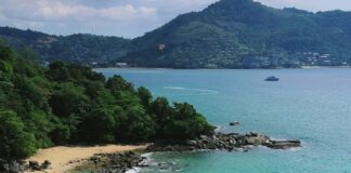
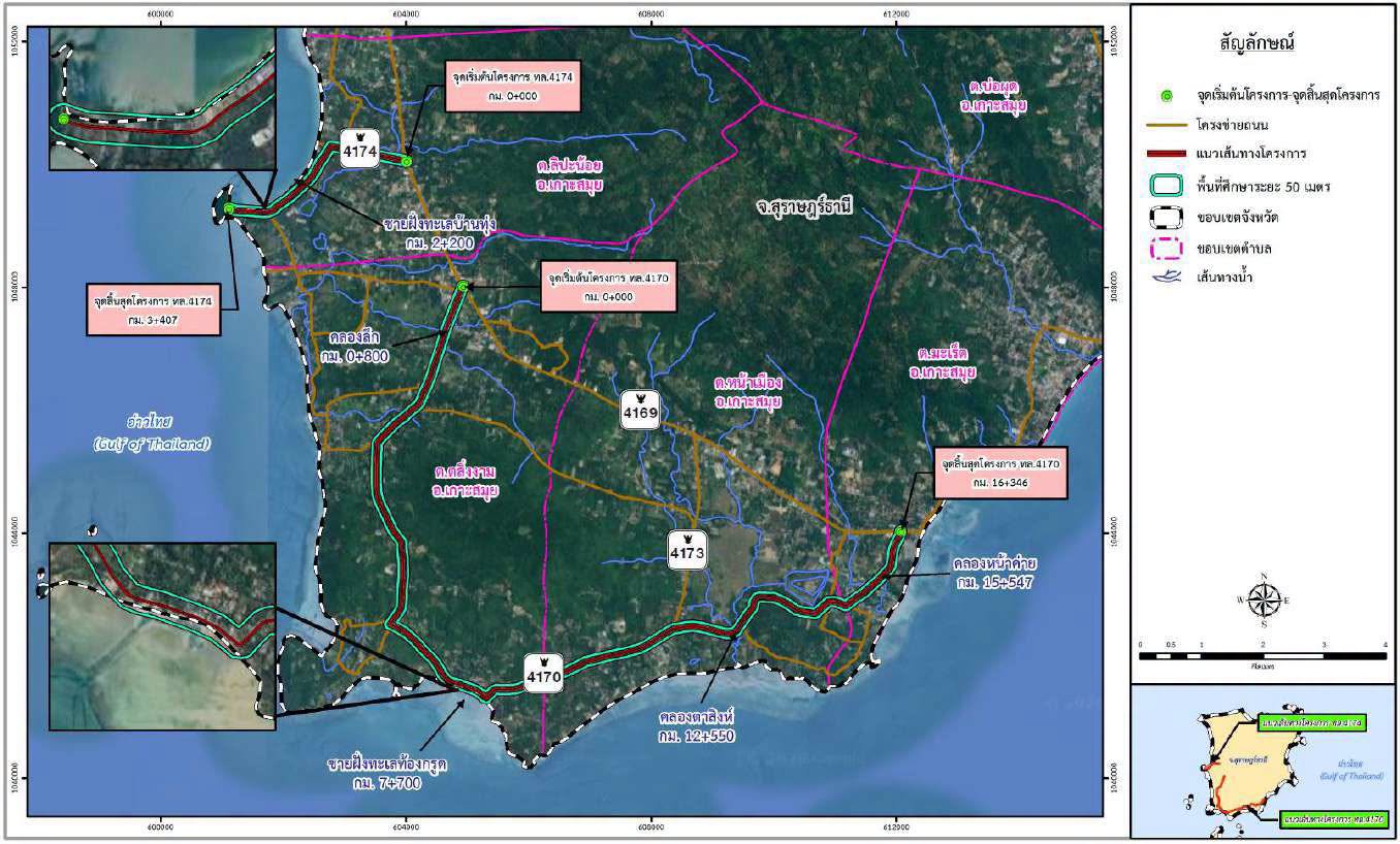
Two roads on Koh Samui are set to be widened, and the power and phone lines that run beside them are set to go underground. The plans cover 19.75km across Route 4170 and Route 4174, both in Koh Samui district of Surat Thani province.

Route 4170 is the road most visitors know as the south coast road. It runs past Thong Krut and on towards Hua Thanon, through some of the quietest parts of the island. Route 4174 is a short link from the ring road out to the west coast near Lipa Noi, where Samui faces the mainland across the Gulf of Thailand.
The two roads at a glance
| Road | Length | Where it runs |
|---|---|---|
| Route 4170, Sa Ket to Hua Thanon | 16.35km | From the ring road near Lipa Noi, along the south coast past Thong Krut, to Hua Thanon in the south east |
| Route 4174 | 3.41km | From the ring road west to the coast at Ban Thung, near Lipa Noi |
| Total | 19.75km | Lipa Noi, Taling Ngam and Na Mueang subdistricts |
What a four lane section looks like
The design drawings show two road types inside the same 16m corridor. Where the road becomes four lanes, each lane is 3m wide, giving a 12m road. A 2m pavement runs along each side.
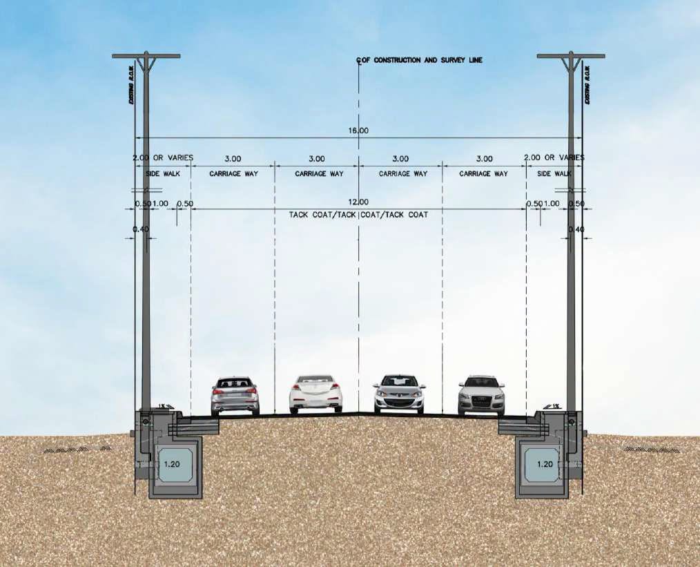
Below each pavement sits a 1.2m concrete duct. That is where the drainage and the cables go. Once the power and phone lines are in the ground, the wooden and concrete poles that line Samui’s roads, and the tangle of wires strung between them, can come down.
Where the road stays two lanes
On the other sections the road keeps two 3m lanes, one in each direction. What changes is everything around them. Each side gains a 2.25m shoulder and a pavement of up to 2.75m. The paved width grows from 9m today to 10.5m, and the same underground ducts run below the pavements.

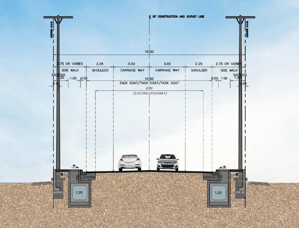
Shoulders matter on an island where scooters, songthaews and delivery trucks share narrow roads. They give slower traffic somewhere to go and give drivers room to stop.
Points along the route
- Khlong Luek, km 0.8 on Route 4170, the first of four canal crossings.
- Ban Thung beach, km 2.2 on Route 4174, on the west coast.
- Thong Krut beach, km 7.7 on Route 4170. This is the small fishing village on the south coast where longtail boats leave for Koh Tan and Koh Madsum, a pair of small islands popular for snorkelling day trips.
- Khlong Ta Sing, km 12.5, and Khlong Na Khai, km 15.5, the last canal crossings before the road ends near Hua Thanon.
Because the route follows the coast and crosses several canals, the project sits inside Samui’s environmental protection zone. The plans include a 500m study corridor around both roads for the environmental review.
Why Route 4170 matters
Route 4170 is also the road the planned Samui sea bridge is set to join. The expressway would run 37.41km from Highway 4142 in Don Sak on the mainland, with a 22km bridge across the sea, and land on Route 4170 on Koh Samui. The current plan targets cabinet approval in 2027, construction from 2029 and opening in late 2033.
When it opens, the crossing that takes around 2 hours by ferry today would take about 20 minutes by car, with tolls expected at 1,000 to 1,200 baht per car. Motorcycles would not be allowed on the bridge because of the wind at height.
A wider Route 4170, with its cables underground, is the road that bridge traffic would feed into. It is also the road that links the south of the island, including Thong Krut, Taling Ngam and the villages around Hua Thanon, to everything else.
What it means for residents and visitors
For now, the south and west of Samui remain the island’s slower side, with fewer resorts and more coconut plantations than Chaweng or Lamai. Better roads and a cleaner streetscape tend to bring more homes, cafés and hotels with them, as they have along other upgraded stretches of the ring road.
Expect roadworks once construction begins, and allow extra time on the south coast road while the ducts go in. We will update this story as the project moves forward.
Common questions about the Samui road widening
Which roads on Koh Samui are being widened?
Route 4170, the 16.35km south coast road from Sa Ket to Hua Thanon, and Route 4174, a 3.41km road near Lipa Noi on the west coast.
Will the overhead cables be removed?
Yes. The plans move power and phone lines into ducts below the pavements, so the poles and overhead wires along both roads can come down.
How wide will the new road be?
Both designs fit inside a 16m corridor. Four lane sections have a 12m road and 2m pavements. Two lane sections have a 10.5m paved width, with 2.25m shoulders and pavements of up to 2.75m.
Is this connected to the Samui bridge?
The planned sea bridge from Don Sak is set to land on Route 4170, so the widened road would carry bridge traffic once the bridge opens, which is currently targeted for late 2033.